Protecting Saint-Malo’s waterfront against increasing storm impacts
Integrated modelling enables long-term planning, adaptation and resilience to coastal flooding
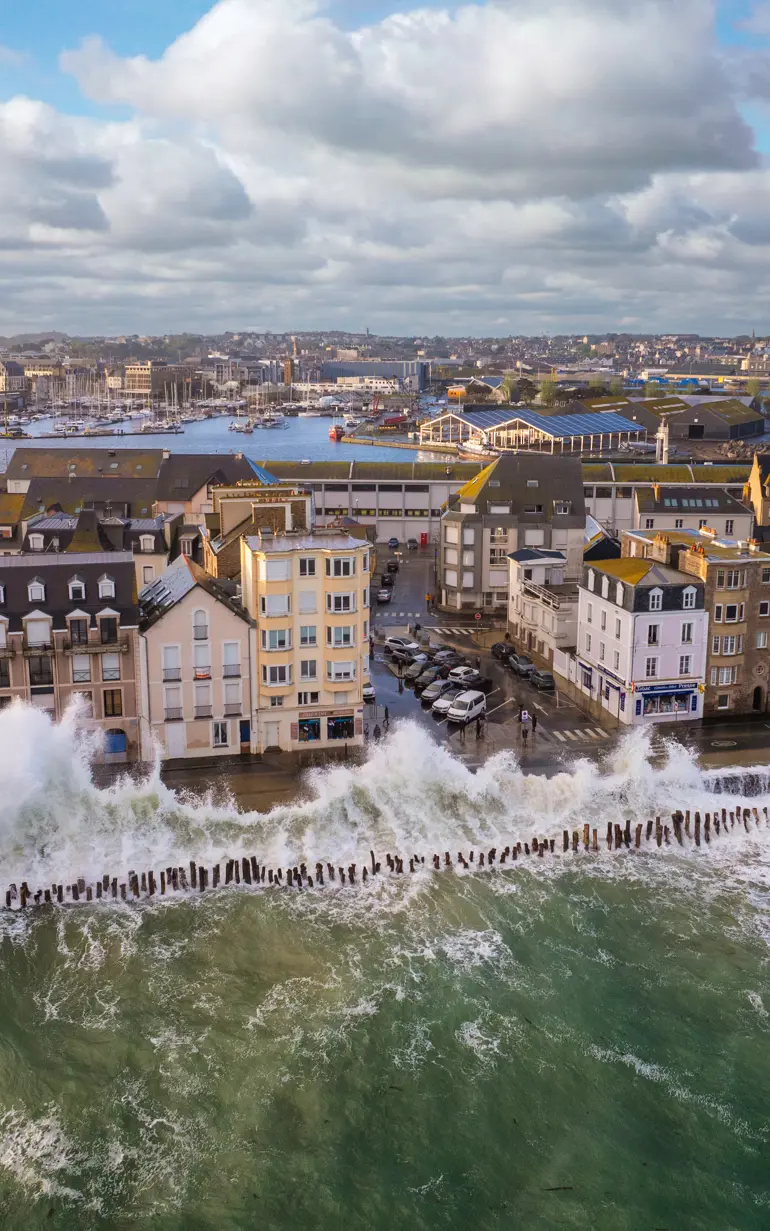
Located at the end of a bay with complex bathymetry, Saint-Malo faces some of the highest tidal ranges in Europe, combined with frequent storm events that cause powerful overtopping along its waterfront. These conditions, along with a lack of historical data, have limited the city's understanding of the hydrodynamic and sediment transport processes shaping the coastline, especially during storms and seasonal changes. To address this, the city of Saint-Malo launched two targeted studies as part of its coastal flood prevention action plan, with support from DHI. The first is a hydro-sedimentary study to improve knowledge of coastal processes and develop numerical models to guide coastal management strategies. The second assesses current and future marine submersion risks, aiming to propose and simulate development solutions. Together, these studies provide a strong foundation for long-term, adaptive coastal protection in response to sea level rise and increasing storm impacts in Saint-Malo.
Challenge
Saint-Malo regularly experiences flooding during high spring tides, exposing front shore homes to damage. When storms coincide with these tides, flooding extends into the inner city, increasing risks to residents and infrastructure. A key challenge is the limited understanding of coastal dynamics, which could lead to ineffective or costly flood management solutions that might also alter the natural landscape with artificial structures. City authorities recognised the need to accurately define coastal flooding risks to make the right planning decisions for the future.
While past studies have provided valuable insights, there remains a need to expand historical data on beach evolution and deepen understanding of the hydro-sedimentary processes influencing sediment transport. Although wave overtopping during storms has been studied, assessments lacked detailed and continuous coverage along the coastline. To build future resilience, Saint-Malo sought a reliable, calibrated modelling tool based on past events to confidently simulate more severe storm scenarios and better protect its communities.
Solution
To address Saint-Malo’s coastal challenges, DHI began by analysing all existing data and studies related to the bay. For the hydro-sedimentary study, a detailed measurement programme was implemented, including regular beach monitoring using topo-bathymetric surveys, drone flights and other methods. In parallel, a comprehensive numerical modelling framework was developed to analyse coastal morphodynamics. This included hindcast modelling of wave propagation and hydrodynamics, local hydro-sedimentary modelling coupling waves, hydrodynamics and sediment transport, longshore drift modelling and high-resolution simulations of coastal morphodynamics over a 10-year period.
For the flooding study, DHI developed a 3D wave overtopping model using MIKE 3 Wave FM and a 2D land flooding propagation model using MIKE+. These models incorporate detailed representations of buildings and the stormwater network, with the overtopping model feeding into the land model to simulate flows over the sea front dike. Both were calibrated against two recent storm events that caused significant flooding.
What makes this solution unique is its integrated, site-specific approach, combining historical data, field measurements and advanced modelling to provide a full understanding of coastal dynamics and flood risks. The use of DHI's MIKE 21 Shoreline Morphology model allows accurate simulation of coastline evolution over 10 years through a combined 1D/2D approach that reflects the area’s complex bathymetry.
Results
The studies provided the city of Saint-Malo with reliable, data-driven tools to support long-term coastal planning and flood risk management. Key outcomes include:
- Decision support for coastline management: DHI’s coastal morphodynamics model allows the city to evaluate the impacts and relevance of coastal protection scenarios such as beach nourishment and restoration of deteriorated groynes
- Accurate simulation of future flooding events: The models enable the city to simulate flooding accurately to assess the effectiveness of projects adapting the sea front dyke system and the stormwater drainage
Client:
Saint-Malo Agglomération
Location:
France
Related SDG(s):
SDG 13: Take urgent action to combat climate change and its impacts
Technology:
'DHI provided essential data and modelling tools that improved our understanding of coastal processes and flood risks. Their work allows us to evaluate protection measures and plan effectively for future storms. This supports more informed, cost-effective decisions to safeguard Saint-Malo’s coastline and residents.’
Guillaume VILLEMAGNE
Coastal Management Officer
Flood Prevention and Water Systems (GEMAPI)
Saint-Malo Agglomération
About our client
Saint-Malo Agglomération is an intercommunal authority uniting multiple municipalities around Saint-Malo to coordinate and manage key regional services and development projects. It oversees economic development by supporting local businesses and job creation, manages public transport, housing and urban planning. It is also responsible for waste collection, treatment and environmental protection, including water management and flood prevention. Through coordinated governance, Saint-Malo Agglomération strives to improve residents’ quality of life and promote balanced, sustainable growth across its member communes.
You may also like
How can we help?
With our global network of offices, we make sure you get the right answers to your local needs. Tell us about your water challenges and we will get back to you.


