
MetOcean Data Portal
Enhance workflows with access to 40 years of metocean data
Reliable metocean data is vital for safety, engineering, operations, environmental assessments, energy projects and coastal management. But finding dependable data is a challenge.
Supercharge your data gathering, analysis and reporting with the game-changing MetOcean Data Portal. Gain subscription-based access to an extensive 40-year archive of global metocean data, transforming the way you work. Say goodbye to frustrating searches for trustworthy data and hello to a user-friendly platform that puts accurate wind, wave, water level and current data at your fingertips. Effortlessly retrieve the information you need through our intuitive interface and seamless API integration. Save precious time and unlock the confidence of having reliable data to fuel the success of your projects.
Interested in the MetOcean Data Portal?
Contact UsHow does MetOcean Data Portal help?
Areas of application

Optimising Offshore and Coastal Projects
Drive efficiency and success across every stage of offshore and coastal projects.

Extensive Wave and Hydrodynamic Data
Access extensive wave and hydrodynamic data from 1979 to date.

Effortless Data Retrieval
Retrieve data effortlessly through a user-friendly interface or API such as cURL, Python, and MATLAB.

Validate with Satellite Measurements
Validate site-specific wind and wave data against satellite measurements.

Minimising Uncertainty with Decades of Data
Minimise uncertainty with decades of time series data, typically 30-40 years.

Seamless Data Integration
Effortlessly integrate data in various formats (e.g., .MAT, .CVS, .NC, .DFS0) into MIKE models and beyond.
Get started
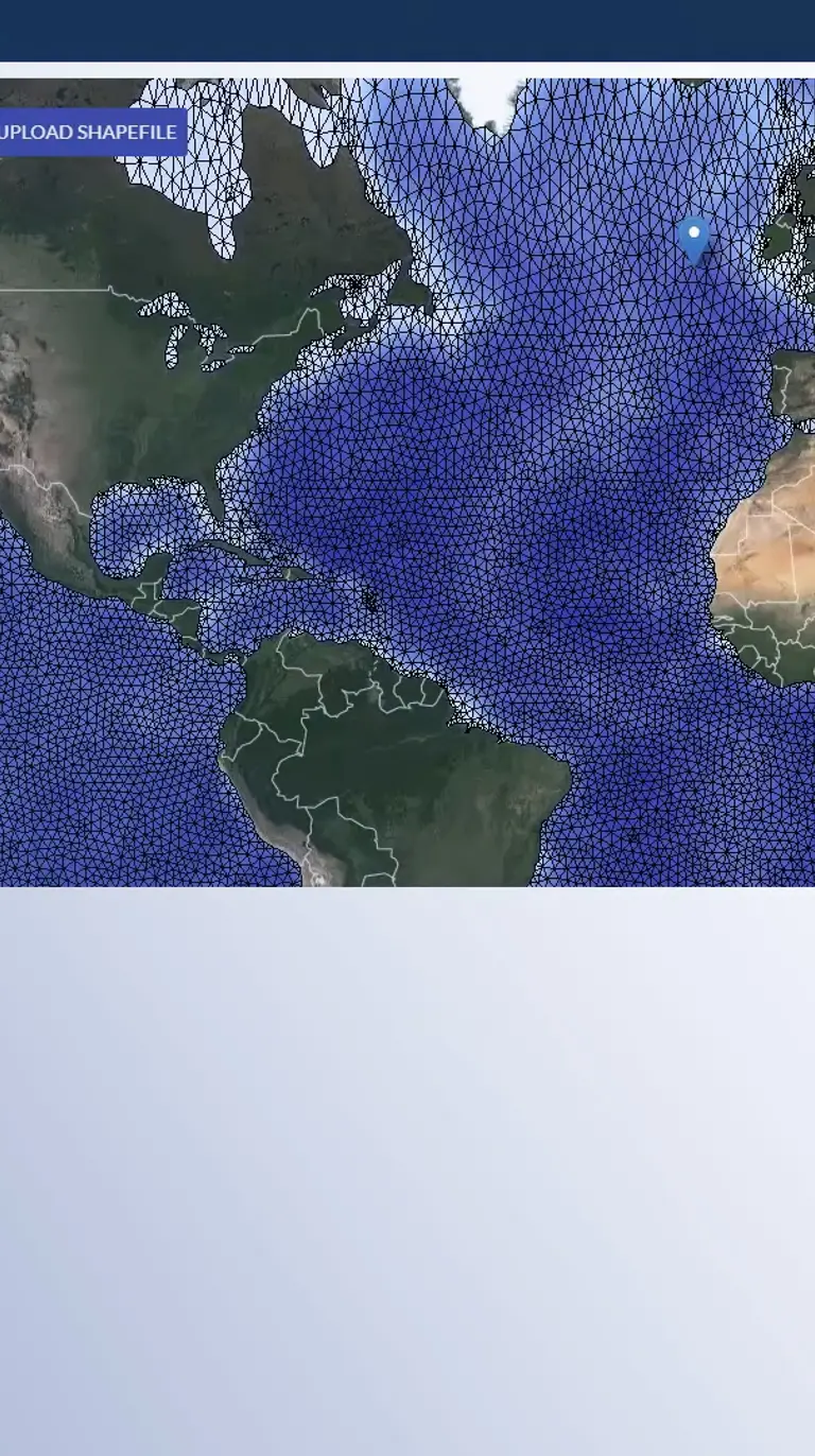
Select the subscription plan that fits your business needs, with the option of Freemium for essential features at no cost, or a comprehensive plan with unlimited access to analytics and data. Once you're in the Portal, just place a marker on the map, select a dataset, and extract data for your area of interest to view, print and download various analytical visualisations, including time series plots, rose plots, altimeter comparisons and more.
Contact us
Discover what this innovative metocean database can do for you. Contact us for a personalised demo and answers to your questions. Unleash the full potential of this incredible technology.
'The MetOcean Data Portal is a leap forward when it comes to the availability and accessibility of decades of high-quality metocean data. It has already greatly improved our responsiveness within planning and FEED design of support structures in the offshore wind sector.'
Anders Sørrig Mouritzen
Director and Technical Lead C2Wind ApS
You may also like
How can we help?
With our global network of offices, we make sure you get the right answers to your local needs. Tell us about your water challenges and we will get back to you.
