Bioroute – Marine sensitivity maps for route planning
Developed by DHI with Danish Shipping and supported by the Danish Maritime Fund
The sensitivity maps describe marine sensitivity based on publicly available data. They are divided into four pressure groups: Presence, Noise, Light and Discharge. Each map is designed to support the assessment and mitigation of impacts related to a specific pressure type.
Select a pressure group below to view and download its map.
If you have any questions, please send an email to emfn@dhigroup.com
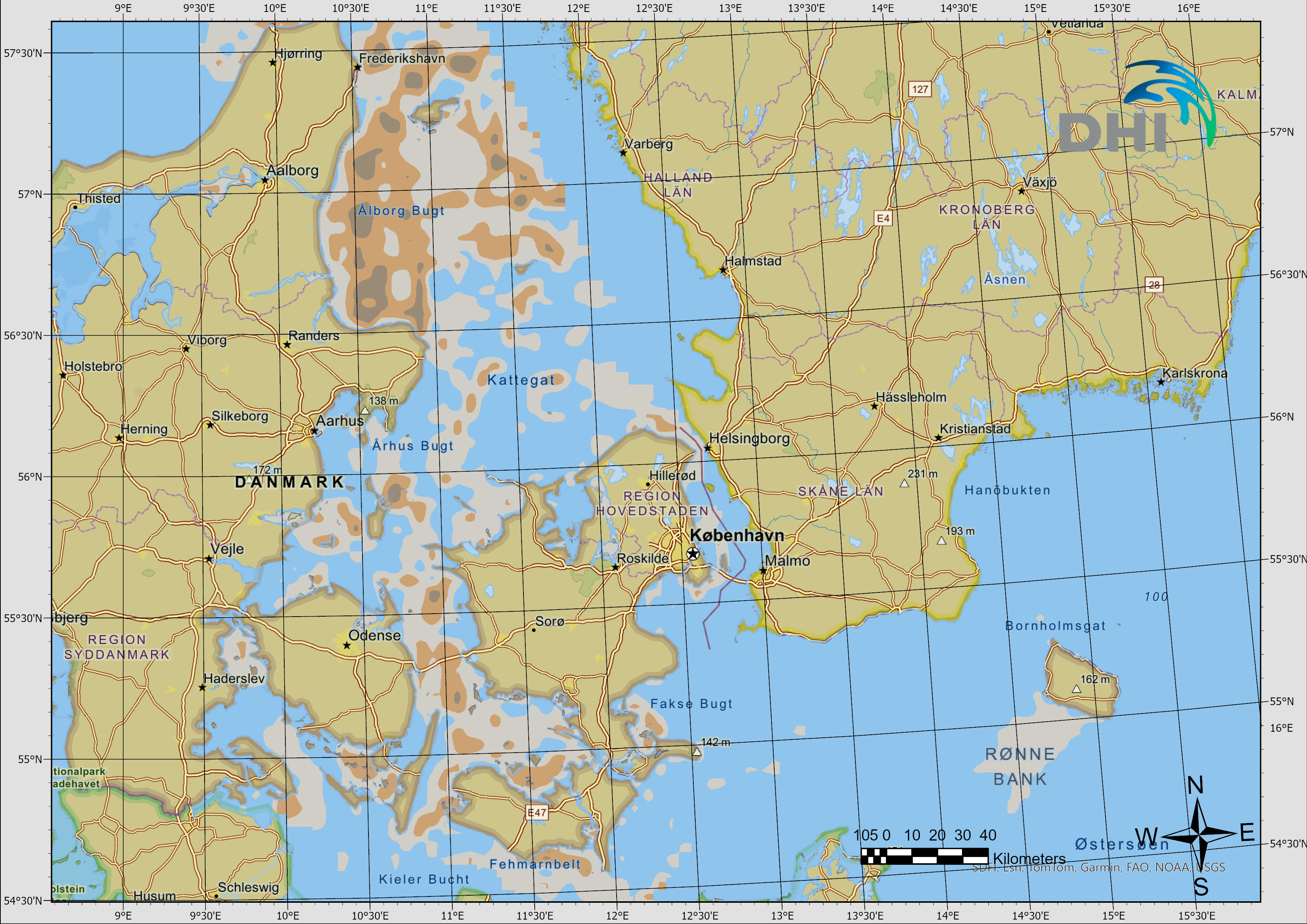
Presence
Sensitivity to the physical presence of vessels and activities, classified as low, medium or high.
View map and downloads →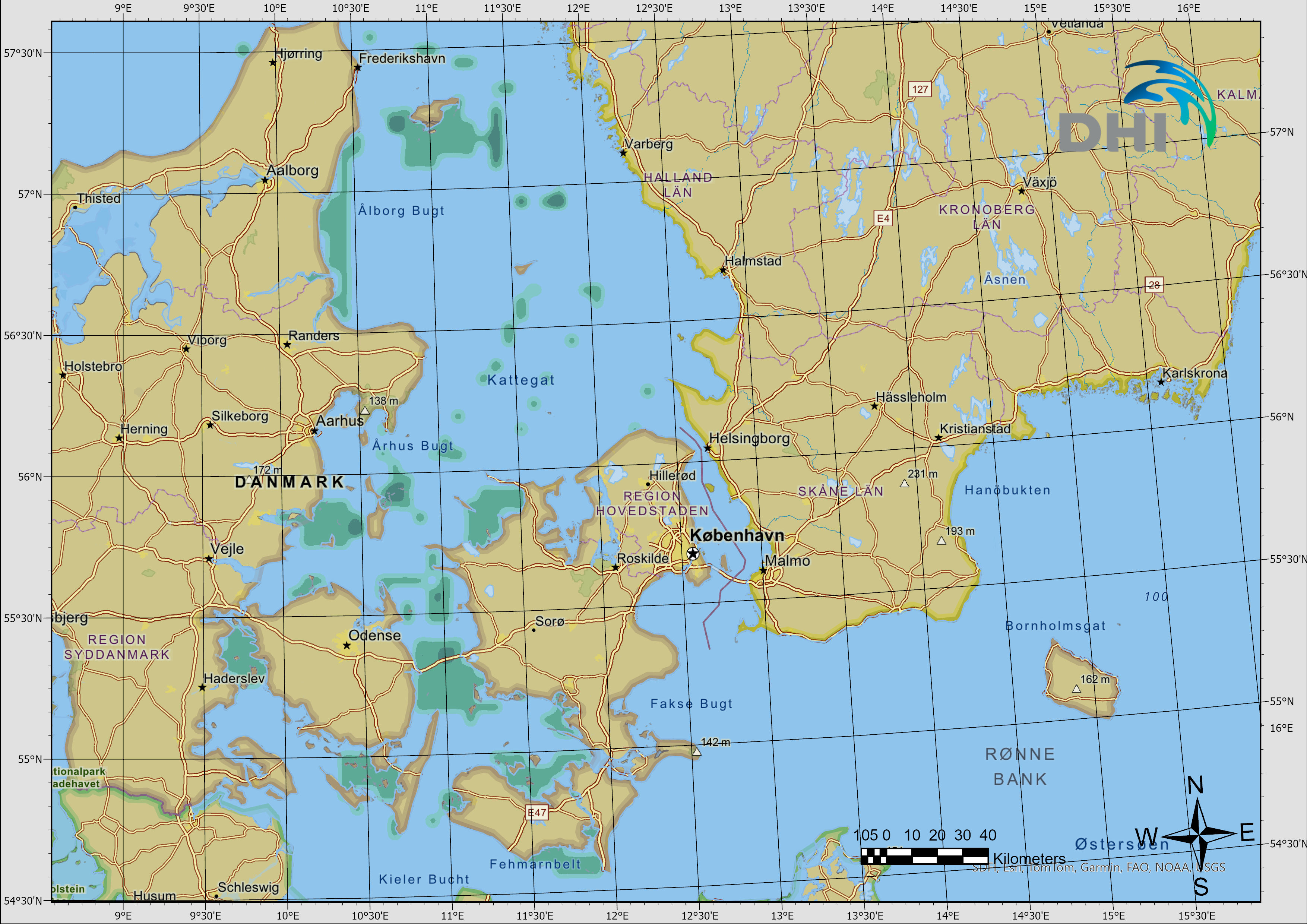
Noise
Sensitivity to underwater noise, classified as low, medium or high.
View map and downloads →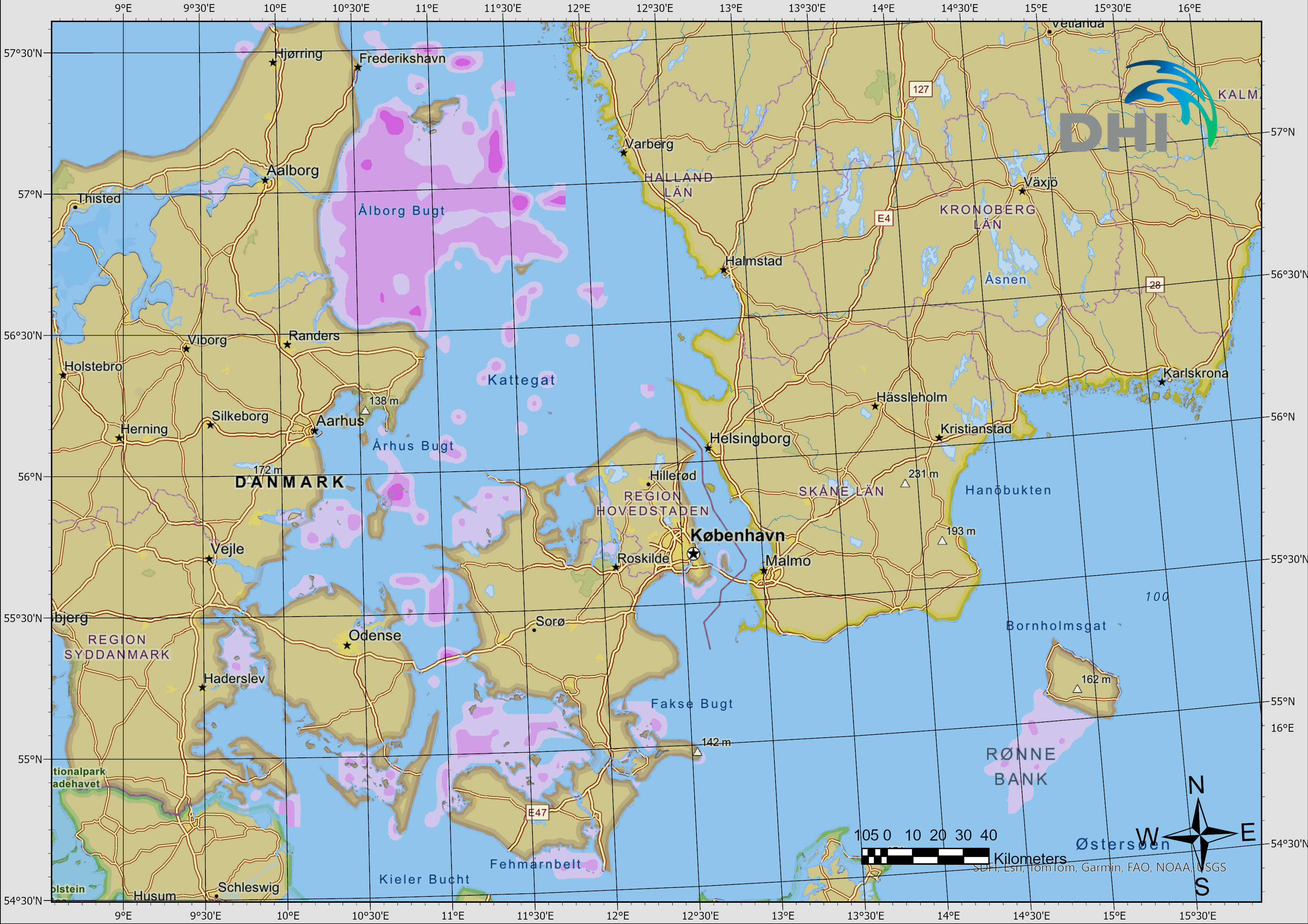
Light
Sensitivity to artificial light, classified as low, medium or high.
View map and downloads →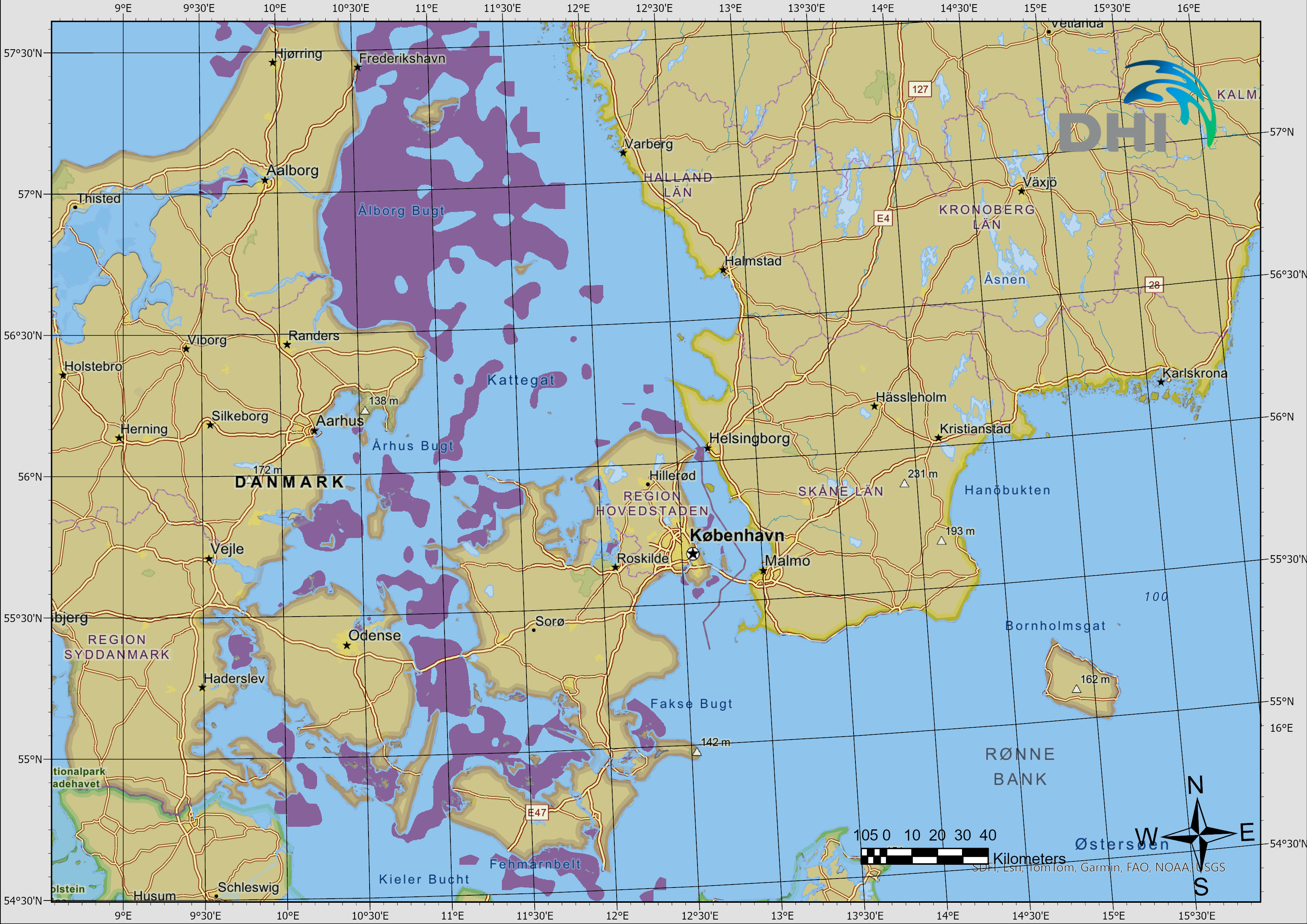
Discharge
Areas where discharge should be avoided.
View map and downloads →Each map is available as SHP, TIFF, JPG and KMZ.